REPORTING BY Elizbeth Kerr
PHOTOS BY Will Hayward & Jono Woodhouse
Hong Kong has four official long trails: Maclehose (100km), Wilson (78km), Lantau (70km), and Hong Kong (50km). The new Tinworth Trail (www.tinworthtrail.com) has been designed as the unofficial fifth. The 90km route starts in the northeast corner of the territory at Sha Tau Kok, runs southwest through the New Territories, hops the bay and picks up in Lantau.
The Tinworth is named for race director and runner Nic Tinworth, who singlehandedly raised the profile of trail running (or hiking) in the SAR. He set up the Hong Kong Trail Running Facebook page which now has over 11,000 members, and co-founded RaceBase, the events company responsible for iconic trail running events like Country of Origin, Nine Dragons and the Great Relay. Nic sadly succumbed to a brain tumour in 2020 at just 44: the runners to whom he meant so much hit on this way to memorialise him.
“We created the Tinworth Trail to give Hong Kong runners and hikers a new challenge, and to honour Nic’s legacy,” co-creator Will Hayward opens, adding. “The Tinworth’s not a government trail. Sometimes they gussy things up and make it kind of nice and install concrete steps. There are a million trails out in the woods if you know where to look, and Nic loved the muddy, scrambly, how-do-Iget- up-there trails, so we have a few of those ‘shiggy’ sections. It’s a bit more challenging, but not impossible. People seem to really like those.”
‘Open’ since November, the Tinworth Trail is divided into 10 sections, much like each of the Big Four. Each section has start and end points that are accessible by public transport, so you can run or hike it bit by bit or all in one go. Of course, its unofficial status means there are no brightly coloured ribbons, signposts or arrows guiding you along the way.
“We used technology to solve that problem,” says Will. “The website has a map and a GPX link. That’s a spatial topographic file that you load onto your phone or your smartwatch, and it will tell you where you are on the trail, and help you navigate. And it works with satellite, so anyone with a smartwatch will be fine if there’s no cell reception, which is rare. Coverage here is terrific.”
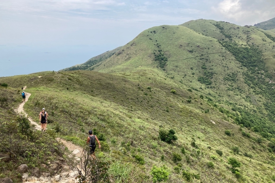
Islanders will likely want to start with the Lantau hikes – sections 7 to 10. Highlights include Tiger’s Head, a 700-metre climb out of Pak Mong, Wong Lung Hang Valley and the Tung O Ancient Trail.
“We wanted to stay off the Lantau Trail as much as possible,” Will says. “We’ve done that reasonably well. The Lantau Trail is basically the southwest. There’s nothing in Discovery Bay and nothing in Tung Chung, so we stayed on the north side. It starts at Sunny Bay, passes Disneyland and then you start climbing the hill between Sunny Bay and Discovery Bay. It’s a little more overgrown, and has great views over Penny’s Bay. Then it climbs Tiger’s Head and comes down to Pak Mong, up towards Sunset Peak and joins the Lantau Trail for about 800 metres.”
SECTION 7: SUNNY BAY TO DISCOVERY BAY – 6km distance, 524m elevation
The Lantau portion of the Tinworth Trail starts outside Sunny Bay MTR at the board showing a map of the surrounding area. Taking the footpath from the station, zigzag your way between the parking areas and the railway line, and go through the underpass. On the other side, cross Cheung Tung Road and then Sunny Bay Road. Finding yourself on the north side of Sunny Bay Road, head towards Disneyland (away from the station).
Before long the ground slopes downwards and on the right, you find a walkway under Sunny Bay Road. Once on the other side, turn right and start heading back towards the railway line, now on the south side of the road. You quickly find a trail on the left heading up the hill; follow it up and up over Lai Pik Shan and on past the communications station at Tai Che Tung, then down towards Discovery Bay.
The stage finishes at the path that comes up from Neo Horizon at Discovery Bay. There’s an exit here, down an obvious path that is uneven in places.
SECTION 8: DISCOVERY BAY TO PAK MONG – 7.4km distance, 321m elevation
This section kicks into gear at the Discovery Bay Lookout (already 200 metres above sea level). The climb up and over Tiger’s Head (Lo Fu Tau) provides outstanding views of Discovery Bay on one side and the back of Lantau looking across to Tuen Mun on the other. The path looks a lot shorter than it actually is, but it flattens out for 10 metres every now and then.
Tiger’s Head summit is about 50 metres off the Tinworth Trail and well worth a detour. Take a left – a short climb takes you right up to the giant stone on the top of the hill shaped like the head of a tiger. The views are incredible here; you can see the whole of Discovery Bay and appreciate just how far you’ve climbed.
After enjoying the view, head back to the Tinworth Trail and carry on down the Lo Fu Tau Country Trail for about 3 kilometres until you reach the Olympic Trail. Turn right and follow the Olympic Trail all the way to Pak Mong Village.
SECTION 9: PAK MONG TO YU TUNG ROAD – 10.2km distance, 783m elevation
As you go out of Pak Mong village, you see a trail on the left side, rising steeply, which is initially a little overgrown but quickly opens out. You’re starting one of the most challenging climbs of the Tinworth Trail, almost 700 metres over 5.5 kilometres towards Sunset Peak. Your reward? Incredible views over the central Lantau massif and down towards Tung Chung and the airport.
Eventually this trail intersects with the Lantau Trail; turn right and follow the Lantau Trail for less than 1 kilometre, then take the turnoff down Wong Lung Hang valley. In the valley, you drop back to sea level over about 2 kilometres.
At the bottom of steep steps, you reach Wong Lung Hang Road; turn left and follow it out to Yu Tung Road, which you reach by taking an elevated pedestrian walkway over the road and down the other side. You can exit here to Tung Chung by walking about 1 kilometre.
SECTION 10: YU TUNG ROAD TO TAI O – 13.7km distance, 288m elevation
The last stage of the Tinworth Trail largely follows the Tung O Ancient Trail around the coast to Tai O. Go along Yu Tung Road about 500 metres then take steps down to the right and follow the path past a sports field and through wetland until you find yourself on a concrete trail that passes under the cable car. You pass through a series of villages, with the airport on your right until suddenly you turn a corner and it disappears.
The last 3 kilometres of the Tinworth Trail provides wonderful views across the Pearl River Delta. On entering Tai O, go along the eastern side of the river until you find a bridge just before the road which takes you towards a housing estate. Follow the main road for about 500 metres and finish beside the bus terminal at the entrance to the historic part of Tai O.