Determined to hike the entire LantauTrail, Claire Severn tackles sections1,2 and 3 which take her from Mud Wo to Ngong Ping, and up and over both Sunset and Lantau Peaks.
Photos by Andrew Spires & courtesy of Unsplash
I’ve had a great idea!” I said. “Let’s hike the Lantau Trail – all 12 sections!” I said. “I’ve hiked parts of it before, how hard can it be?” And so a plan began to hatch.
Beginning in Mui Wo, two eager Brits would set off on foot and see how far we got in a day. After resting our legs for a week or so, we’d simply pick up where we left off. This was going to be fun! Fast forward a few days, and, backpacks at the ready, my buddy and I met early one morning, filled with energy and enthusiasm. After a quick pitstop at Mui Wo Wellcome (the village eateries don’t open as early as we thought), we were finally ready to begin our climb.
One of the easier parts of the Lantau Trail, section 1 begins at Mui Wo Ferry Pier and follows a steady slope up the road back towards Tung Chung. There’s nothing really remarkable about this section – the biggest challenge we faced was dodging all of the buffalo deposits – but if it’s good for one thing, it’s a nice way to stretch out the legs before the challenge ahead. And boy, is it a challenge!
NAM SHAN TO SUNSET PEAK
The hard work all began when we reached section 2. Setting out from Nam Shan, the path starts off gently, with a pleasant stroll through the trees, past a helipad and down towards a crossroads where you can either choose to take a left to skirt the side of the mountain (a good option with kids) or head straight on towards 869-metre Sunset Peak. On we went.
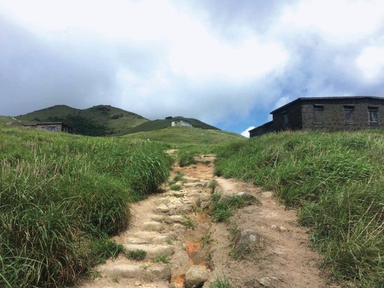
At this stage, things start to heat up – the trees provide relief for a while, but soon the steps open up to a more barren landscape with little shade. What surprised us was how far we still had to go whenever we checked our location. Heading east, the route to the top is long and at times steep, but the effort is rewarded by beautiful views over the South Lantau coast. I soon lost count of how many times we said “Wow.”
One of the most interesting features of the walk is around distance post L013, where 20 stone huts come into view, scattered across the hillside. Said to have been built in the 1920s by Christian missionaries, the eerie-looking buildings are now boarded and locked up, and appear both intriguing and spooky at the same time.
Not long after passing the huts, we found the path to the summit. The trail itself doesn’t actually pass over the very top of the mountain, however by taking the right-hand path when the trail splits, we soon spotted the black and white marker that said we’d done it – our first mountain was conquered!
After a short refuelling stop, we retraced our steps to get back to the trail and set off again downhill. Down is easy, right? By the time we reached Pak Kung Au, we certainly didn’t think so! Were our legs too tired to carry on? It was debatable, but knowing that we had 10 more sections of the trail to cover to complete our challenge, we decided to crack on with section 3. We crossed the road, and began the climb up Lantau Peak.
SCALING LANTAU PEAK
At 934 metres, Lantau Peak is the second highest peak in Hong Kong, second only to Tai Mo Shan. Were we crazy to tackle it on day one? Looking back, yes, but at the time, oh the kudos! I’d love to be able to report on the stunning vistas and incredible wildlife we encountered but by the time we were half way up the hill, all we could focus on was how to keep on going. It was truly exhausting; and it took a fair few Kit-Kat breaks to get us where we wanted to go.
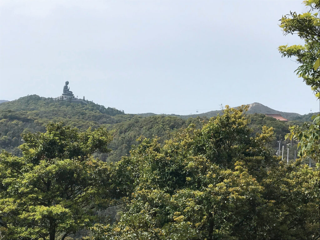
The sense of achievement when we reached the top of Lantau Peak really was something. And the views are amazing, as long as you’re not stuck in a cloud. It’s just a pity you have to climb so many steps to get there – and to get down the other side! How our legs actually supported us as we navigated the giant steps down towards Ngong Ping, I’ll never know. Ask anyone who saw us for a week afterwards and they’ll still cry with laughter recalling our Bambi-like appearance on any downhill surface.
But we did it! 13.5 kilometres (with a maximum elevation of 934 metres) in 6 hours 20 minutes! Time for a well deserved ice-cold beer at the foot of the Big Buddha. With the first three sections of the Lantau Trail under our belts, we’re already planning how to tackle the remaining nine. So that’ll be a story for next issue…
THE LANTAU TRAIL\
A 70-kilometre loop starting and finishing in Mui Wo, the Lantau Trail is the third longest in Hong Kong, after the MacLehose Trail and Wilson Trail. The route is well marked with information boards and maps at junctions between each stage. Distance posts around 500 metres apart help hikers know where they are. At each turning, route signs give instructions about directions, place names, and the distances and times for hiking between various locations.
| SECTION | ROUTE | LENGTH | DISTANCE POSTS |
| 1 | Mui Wo to Nam Shan | 2.5km | L000-L005 |
| 2 | To Pak Kung Au | 6.5km | L005-L018 |
| 3 | To Ngong Ping | 4.5km | L018-L027 |
| 4 | To Sham Wat Road | 4km | L027-L035 |
| 5 | To Man Cheung Po | 7.5km | L035-L050 |
| 6 | To Tai O | 2.5km | L050-L055 |
| 7 | To Kau Ling Chung | 10.5km | L055-L076 |
| 8 | To Shek Pik | 5.5km | L076-L087 |
| 9 | To Shui Hau | 6.5km | L087-L100 |
| 10 | To Tung Chung Road | 6.5km | L100-L113 |
| 11 | To Pui O | 4.5km | L113-L122 |
| 12 | To Mui Wo | 9km | L122-L140 |